Just a brief update. Our group of 13 people from Social Hikers summited Mount Kilimanjaro on January 23rd. We all reached the summit together — a 100% success rate — and made it safely back down the mountain.
It was an epic experience, and one I’ll be replaying for a long time.
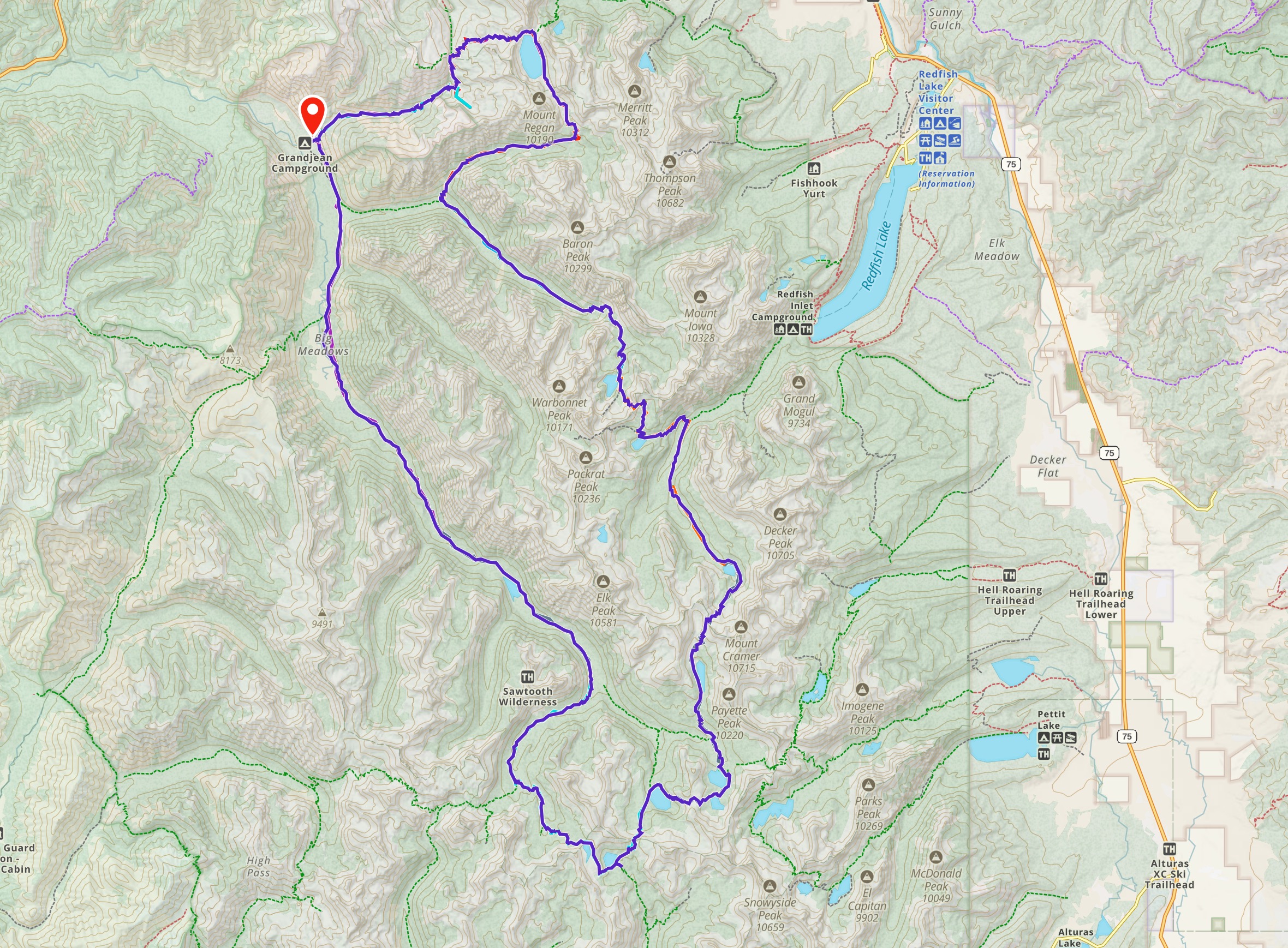
It’s worth noting that our top elevation on the Sawtooth Loop was 9,495 feet — almost 10,000 feet lower than the top of Kilimanjaro. Also, we were carrying all our own gear (~30-35 lbs), whereas we will be carrying less weight on Kili.
For easy reference, on Kili, our total mileage will be 35.75 miles and 69.7 energy miles — less than on this trip.
The big wildcard for Kilimanjaro is the elevation. At sea level, the effective percentage of oxygen in the air is around 20%. At the top of Kilimanjaro it’s about 10%, making our bodies work that much harder to get enough oxygen to hike (see this altitude to oxygen chart for reference).
There is no simple modification to Petzoldt’s energy mile theory that accounts for the additional effort required with less oxygen, but it’s safe to say it will take longer, require slower movement, with more frequent and longer rest breaks.
The takeaway from this? We worked hard on the Sawtooth Loop backpacking trip. If the elevation were not a factor on Kili (though it most definitely will be), this would’ve measured as a more difficult hike, done in six days vs the seven we will take on Kili.
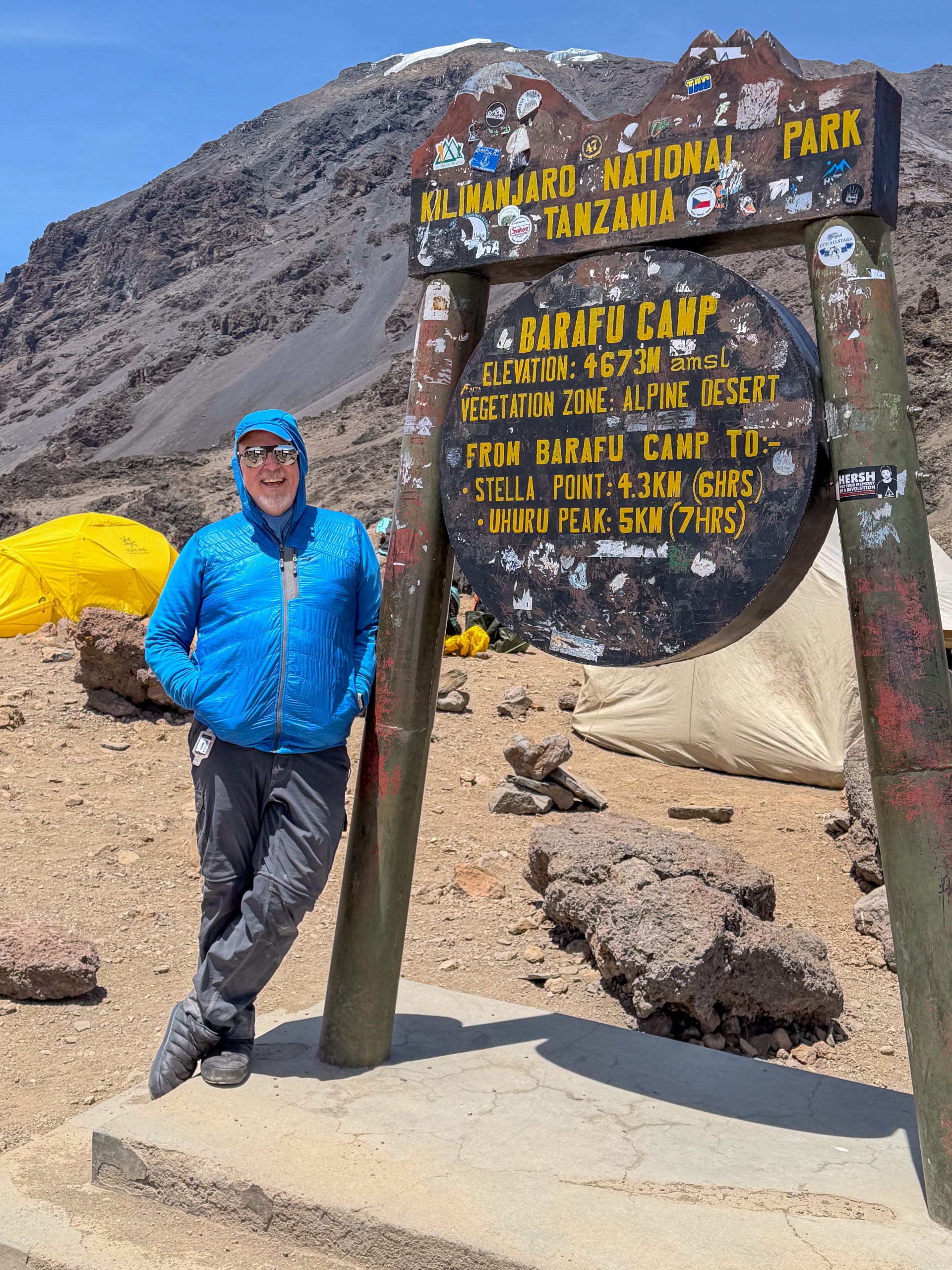
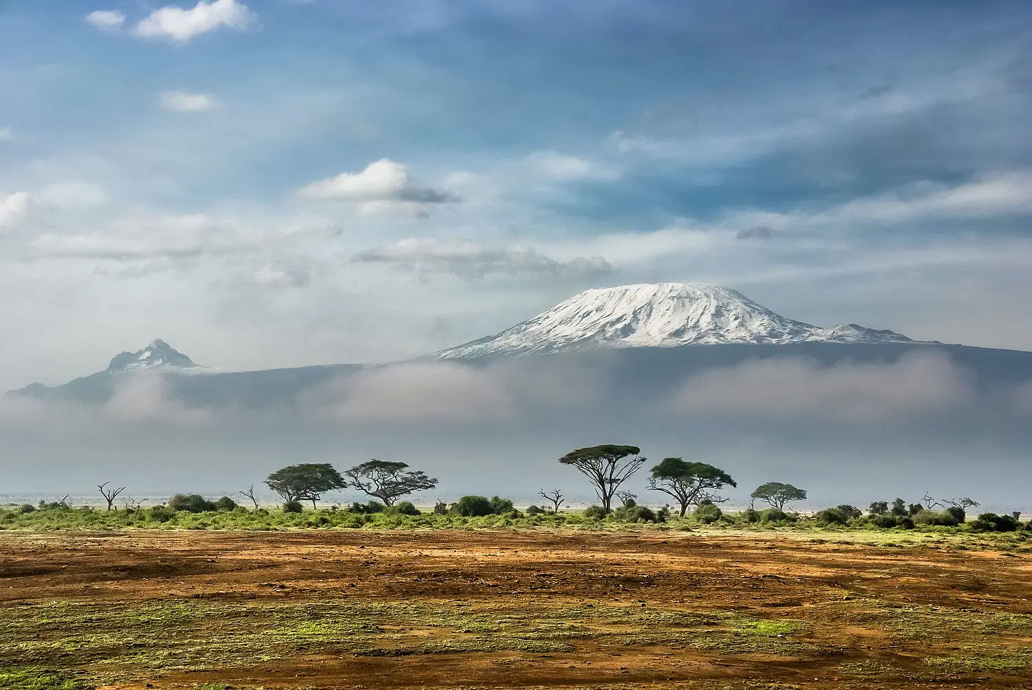
In January 2026, I’ll be climbing Mount Kilimanjaro in Tanzania. I’m organizing a group of intrepid adventurers from the Social Hikers community for to climb this mountain via the Machame or “Whiskey” Route. And as of June 18th, we have room for additional group members. Join me!
At 19,341 feet above sea level, Kilimanjaro is the highest peak on the continent of Africa, making it one of the Seven Summits. It’s also 4,836 feet higher than the tallest peak I’ve hiked to date, Mount Whitney.
There are a number of factors that make this challenging. The weather can be wet, cold, snowy and windy. I don’t mind cold — I’ve experienced that on Mount Rainier — but I’d be very pleased if it didn’t rain on us.
The elevation is the big wildcard. I’ll be talking to my physician about a prescription for Diamox to help prevent altitude sickness, and I’ll be summiting at least four 14ers this year to see how my body responds at higher elevations. It’s been seven years since I last summited a 14er.
Then there is the hiking itself. I’ve estimated the daily milage and the gross elevation gain (and loss) each day, and the actual mileage is not bad. The gross elevation gain is non-trivial, but nothing I haven’t done before. Just not at 19,000 feet.
The table below shows the approximate mileage each day as well as the gross elevation gain. As you see, our mileage each day never goes over 10 miles, and our elevation gain does not exceed 4000 feet.
Day
Itinerary
Mileage
Elev. Gain (ft)
Energy Miles
1
Base to Machame Camp
7
3951
14.9
2
Machame to Shira Camp
3
2849
8.7
3
Shira to Barranco Camp
6
2687
11.4
4
Barranco to Karanga Camp
3
1404
5.8
5
Karanga to Barafu Camp
2
2096
6.2
6
Barafu to Summit to Mweka Camp
9.75
3993/(9200)
17.7
7
Mweka to Base
5
(4718)
5
TOTALS
35.75
16,980
69.7
What are Energy Miles?
What you might not be familiar with is the last column, labeled Energy Miles. In 1976 Paul Petzoldt the founder of the National Outdoor Leadership School (NOLS) created a formula for hikers to calculate their energy needs. The formula estimates “energy mile” units. One “Energy Mile” is the energy required to walk one mile on flat terrain. The formula adds two more “energy miles” for every 1000 feet of elevation gain.
Using this formula, the energy miles approximates the effort of walking a level route. So the first day’s 7 miles and 3951 vertical gain would roughly equate to hiking 14.9 miles on a flat trail.
This does not account for the increased difficulty (or more accurately, the diminished efficiency) of hiking at higher elevations where there is less oxygen available. But it does provide a way of normalizing the daily mileage numbers into something a little more realistic.
My Kilimanjaro Training Plan
In my experience, the best training for hiking is… hiking. The reality is that it’s not always practical to devote 6-8 hours hiking several times a week. And so, my training incorporates three key components:
Hiking and Backpacking – I’m aiming to do at least one long hike each weekend, as well as back-to-back day hikes and backpacking.
Cardiovascular Fitness – My go-to for this is a 45 to 60 minute ride on my Peloton 3-4 times each week.
Strength Training – Legs, core, back and shoulders 2-3 times each week.
Because my climb is in January, most of the higher mountains here in Central Oregon will be covered in snow from November onward, so it will require some creativity to get those long hikes with vertical gain in, and probably more snow hikes up Black Butte.
Have you climbed Kilimanjaro? Any tips to share for training? Is Kili on your bucket list? Leave a comment and let me know.
I’ve been using the location-based social network Foursquare since 2009. Although it will come as no surprise to those who know me, my first check-in was at a Starbucks — although I was surprised to find it was in West Hollywood.
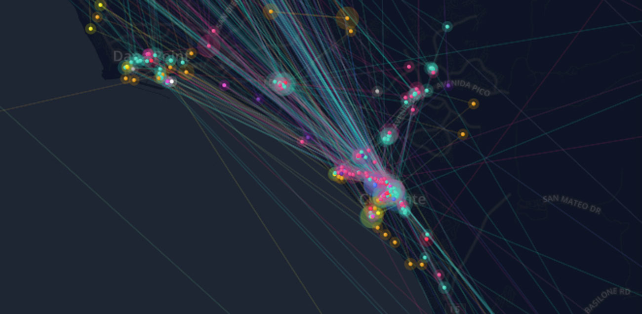
Since then, I’ve checked in 4,456 times, across the United States and around the world. What does this look like? Foursquare put together a Time Machine that takes you on a visual tour of your check-in history. Here’s what mine looked like:
I know some of you see Foursquare as a waste of time. I’ve found it useful, if for nothing else, as my digital memory. When my wife asks me, “What was the name of that souffle place in Paris that we loved?” I can tell her. And because I’ve used Foursquare regularly over the past four years, there’s a lot that the data says about me.
The Time Machine not only produces a slick animated history with an semi-annoying soundtrack, it also cranks out the requisite infographic. I’ve broken it into chunks to share my analysis.
First, there’s a heat map that shows where most of my check-ins have occurred. From 2009-2012, I lived in south Orange County, so this doesn’t really surprise me. You can see regular visits to places in Dana Point, as well as my work in Aliso Viejo.
Each of the colors represents a different kind of location. By far, most of my check-ins have been at restaurants and coffee shops. But the top spot goes to the office.
The category with the fewest check-ins is college and education. Again, since I’m not a full-time student, not surprising. When you look at the breakdown by year, you’ll notice a big growth in the number of outdoors and recreation check-ins. While I’ve always been active outdoors, I haven’t always made a point of checking in (you go outdoors to unplug, right?). Apparently my view has shifted.
My favorite place? No question about it — Starbucks. I’ve logged 830 coffee shop checkins. And my favorite food? The data says I love Mexican food best, followed closely by… tacos? Go figure.
When you look at patterns in activity, you’ll see that I most often grab a caffeine fix before heading to the office.
I was disappointed that their map didn’t show my international travel. But I have done a fair amount of travel around the country. My most visited cities? Where I live or work.
What does all this data tell me?
Not anything that I don’t have a pretty good general feel for. I like coffee (especially Starbucks) and Mexican food. I have been pretty consistent about checking in. And if marketers want to mine this data? Have at it. I’ll be watching my mailbox for invitations to coffee and tacos (I am, after all, a loyal customer).
What I love about Foursquare I’ve touched on before. I have a chance to share my experience with others. I learn from the experience of others (“try the french toast!”). And I have a virtual diary of where I’ve been, and when. That has proven useful to me personally over and again, and remains the main reason I continue to use Foursquare. Your mileage may vary.
If you’re a Foursquare user, give the time machine a spin yourself. And let me know what you think about living out loud, geographically-speaking.
Today is a travel day. Our driver picks us up in front of the apartment at 10am (Paris time, mind you). From CDG we take a short flight to Heathrow, then the long leg to LAX.
Unfortunately (or perhaps, fortunately?) there’s no wifi on these flights, and I’ve got to get ready to go. This post will be short and sweet.
Paris has been amazing. The people have been warm and wonderful, with the occasional big city indifference. Joan and I loved being here for three weeks. I could see living here some day — not forever — but definitely for a while.
I enjoyed the break from the routine, and will resume more serious posts as soon as I get settled back into the groove. Hope you enjoyed following my Project 365 photos during our holiday.
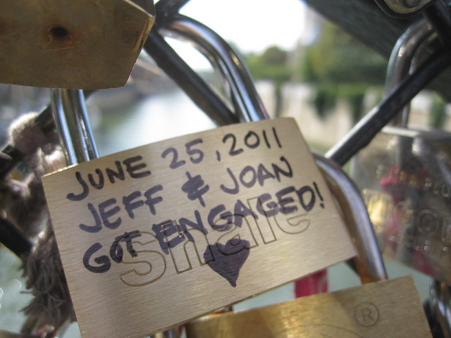
If you look closely, you’ll find our lock on this bridge near Notre Dame.
This is a wonderfully odd real-world meme. The story I heard from a guy in our cooking glass (who has lived here in Paris for the past nine years) was that the guy who started this was despondant over unrequited love. He “locked his love” to the bridge, the jumped off and drowned in the Seine.
Not sure if that’s true, but since then, lovers have taken the idea to an extreme. And area sales of padlocks and Sharpie pens has never been better.
Oh, if you look closely, you’ll see a padlock for Joan and I, too. And that alone was reason enough for me to chose this as my Day 189 photo for Project 365.
One of the meals we wanted to enjoy was fondue. A quick search on Yelp turned up what sounded like a fun place in Montmartre called Refuge des Fondus. It’s small with a fixed menu. You get an apertif, an entree, your choice of cheese or beef fondue, wine (served in baby bottles to avoid the per glass tax), and if you choose, desert afterwards.
There are a row of tables along each wall of the narrow restaurant, with no room to scoot to the bench. So the waiter helps the ladies step on a chair and hop OVER the table.
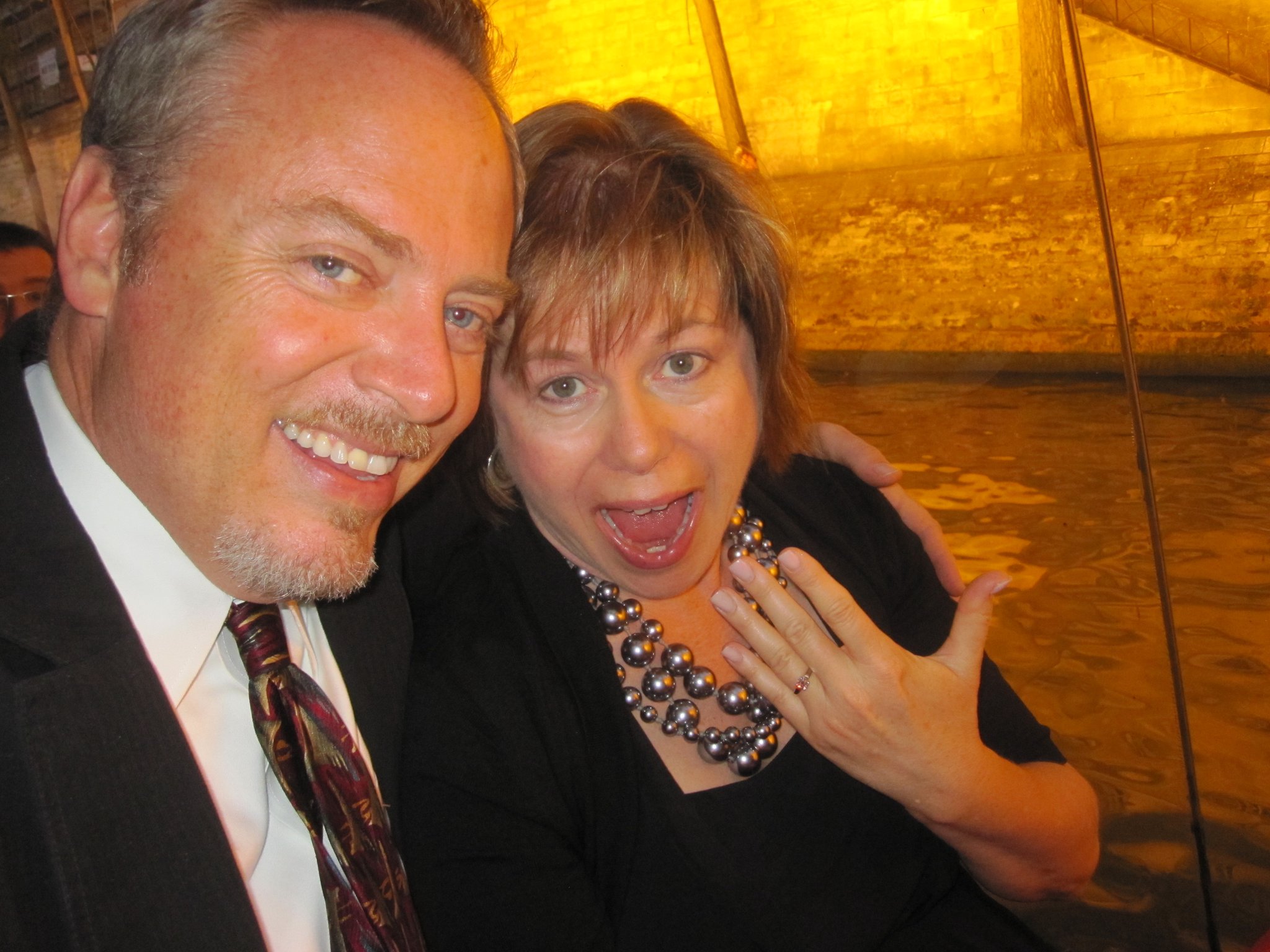
When you’re finished, you can sign your name or leave a message on the wall, the ceiling, or anywhere you can find a scrap of available space. That’s what you see behind the beautiful Joan in this photo, #188 from Project 365.


 I’ve been using the location-based social network